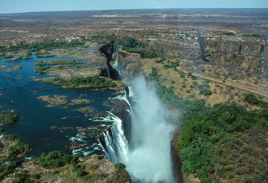
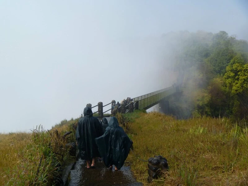
The Victoria Falls, the largest waterfall in Africa and the greatest sheet of falling waters in the world, ranks as one of the best destinations you would enjoy visiting in the Southern part of Africa. The amazing history of the falls and the interesting view of the surrounding areas are stunning. It is also among the longest falls around the globe. The falls remain visible as far as five kilometers away and their location is a wonder by itself, worthy of your visit.
Victoria Falls is located at the border of Zambia and Zimbabwe, along the Zambezi River.
Zambia borders the falls to the north while Zimbabwe lies on the southern part of the scenic falls. The strategic location of the falls makes them easy to access, gives the destination more aesthetic value and allows tourists to visit the surrounding areas and learn the history surrounding the Victoria Falls and their surroundings. In this write-up, we cover the size, history, travel routes and why you need to list Victoria Falls in your destinations, among other interesting facts, to guide you and prepare you for the wonderful experience you would have after visiting Africa’s largest falls.
How Big Is Victoria Falls?

Roughly, Victoria Falls is twice the height of Niagara Falls.
A comparison of Victoria Falls with other renowned waterfalls in the world has been done below, to give us a deeper understanding of how wondrous Victoria Falls is and why it deserves to feature among the Seven Wonders of the World.
| Name of Falls | Size in meters (height by width) | Location |
| Victoria Falls | 108 m by 1708 m | Zimbabwe-Zambia Border |
| Niagara Falls | 51 m by 30 m | Canada-US Border |
| Iguazu Falls | 82 m by 2700 m | Argentina-Brazil-Paraguay Border |
| Angel Falls | 989 m by 150 m | Venezuela |
| Yosemite Falls | 739 m by 272 m | California |
| Gavarnie Falls | 440 m by 281 m | France |
Who Discovered Victoria Falls?
David Livingstone, a Scottish missionary, discovered the falls in 1855.
Livingstone, on discovering the falls, named them after Queen Victoria, the then queen of the United Kingdom of Great Britain and Ireland, to honor her. However, the indigenous residents of Zambia and Zimbabwe named the falls “Mosi-oa-Tunya” to mean “the smoke that thunders” and the name has remained over the generations.
Livingstone was not silent about the beautiful scenery and the magnificence of what he saw while navigating along the Zambezi River. He even recorded in his diaries the memories of the natural attraction sites that “No one can imagine the beauty of the view from anything witnessed in England. It had never been seen before by European eyes; but scenes so lovely must have been gazed upon by angels in their flight.”
He spread the message as a European eye-witness and continued with his journeys, exploring the beauty of Southern Africa.
How Can Tourists Get To Victoria Falls?
After you land at the Victoria Falls International Airport (VFA), a taxi or shuttle can take you to Victoria Falls Town in Zimbabwe.
For a close view of the falls while on the ground and a clearer exploration of the surrounding areas, tourists need to travel to Livingstone City, located in Zambia.
The Victoria Falls International Airport (VFA) is 11 miles south of the Livingstone City while the Harry Mwanga Nkumbula International Airport (LVI) sits only three miles north of Livingstone City, across the border of Zimbabwe and Zambia.
There is an overnight train between Bulawayo (Zimbabwe) and Victoria Falls, which is also a convenient and cheaper means to get to the falls. It starts off as the darkness peeps in and towards the end of the journey, you pass right through Hwange National Park, where you enjoy a scenic view of the zebras and antelopes outside while you relax on your bed.
There are lots of luxury but affordable lodges at the Zambezi national park and many more others dot the Zambezi River. Hotels, resorts, motels and camping points are all accommodation areas around Victoria Falls and within its nearest town of Livingstone and the Victoria Falls town. A free shuttle transports tourists from the nearby lodges to the Victoria falls.
What Else is Located In This Area?
The Zambezi River is the main historic feature located here.
Victoria Falls are approximately halfway along the Zambezi River and form part of the river, which is a 2,574-kilometer-long stretch into the Indian Ocean. The Zambezi River ranks as Africa’s fourth-longest river. The river is a habitat for over 75 fish species. It is specifically known for its fighting tiger fish.

The Victoria Falls Bridge is also located around the falls. It is set over the second gorge of River Zambezi, just below the falls, across the river. The bridge was constructed using steel and is 198 meters long and 128 meters high above the gorge below.
Also, the Zambezi National Park is found in the same area. It is an expansive park and together with Victoria Falls National Park, occupies 560 square kilometers of land under conservation. The Zambezi National Park is home to lions, elephants, buffaloes and leopards. Other animals such as giraffes, antelopes, impala and waterbucks also live in the park. All these wild animals make the park another destination whenever you visit Victoria Falls.
How Far From Victoria Falls To Chobe National Park
Only about 100 km (62 miles).
A visit to the Chobe National Park in northern Botswana from Victoria Falls is an easy yet epic experience. A drive by from Victoria Falls to Chobe National Park would take slightly over an hour only.
The gate to Chobe National Park is 6 km west of Kasane (a town in Botswana) and 80 km to the western side of Victoria Falls. To get there, tourists normally fly to the Kasane Airport and then they can self-drive themselves from there. Chobe National Park prides itself on unmatched populations of elephants, bird species and vast buffalo herds. It borders Namibia but also extends to touch Zambia and Zimbabwe, occupying about 11,700 square kilometers.
